Search engine
A search engine for tourist content with the ability to aggregate external and own content
The solution was designed as an independent engine made available as an API, enabling easy integration with external websites and mobile applications.
A search engine for tourist content with the ability to aggregate external and own content
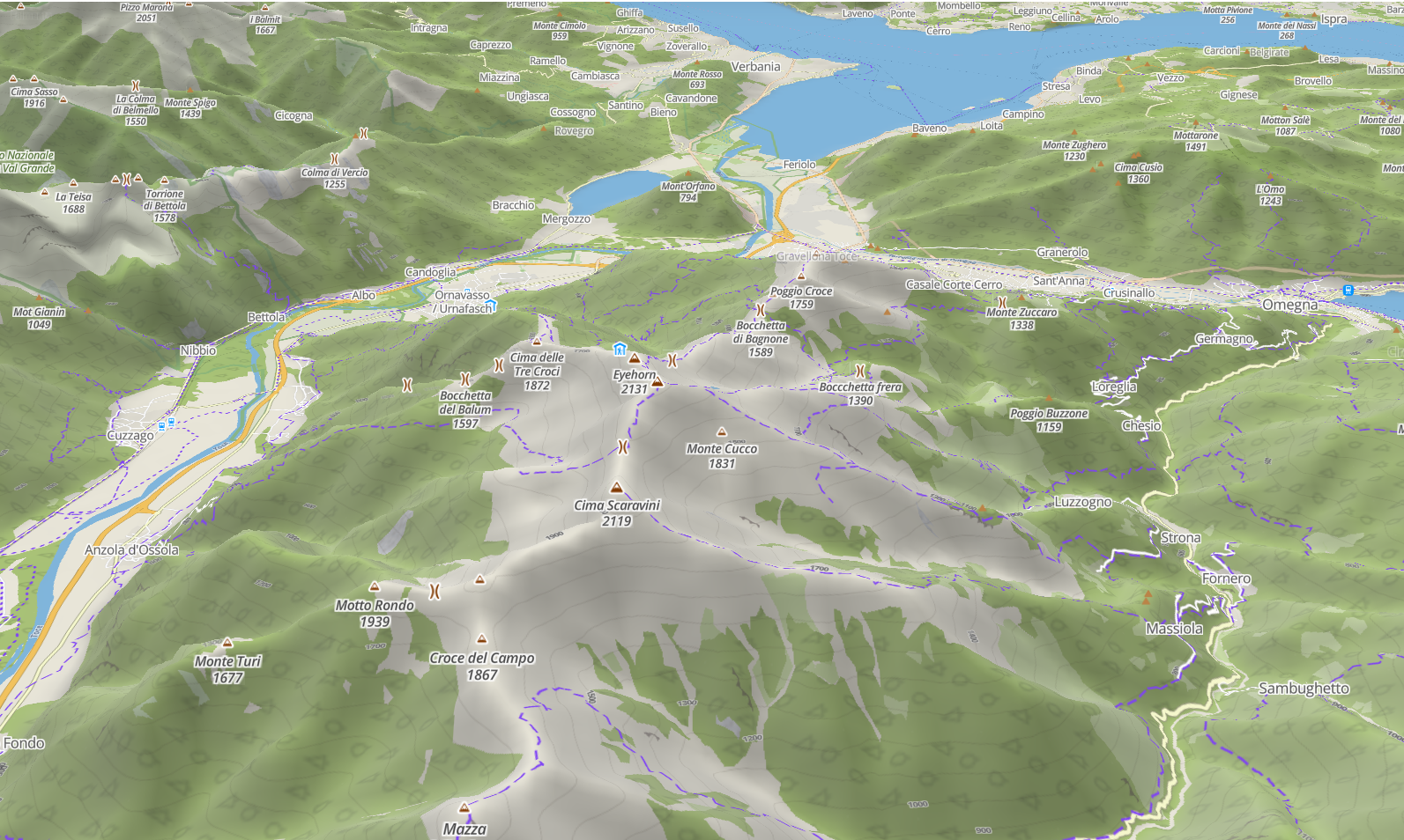
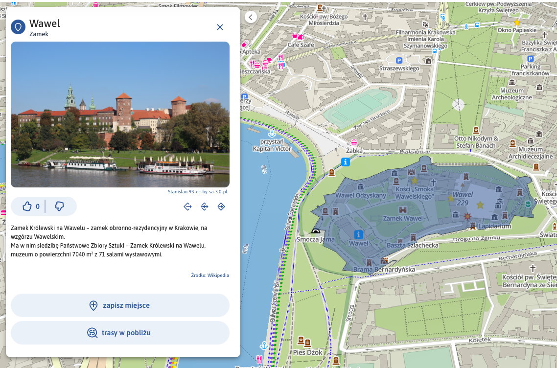
A vector map base of a tourist nature with a very intuitive layer configuration option
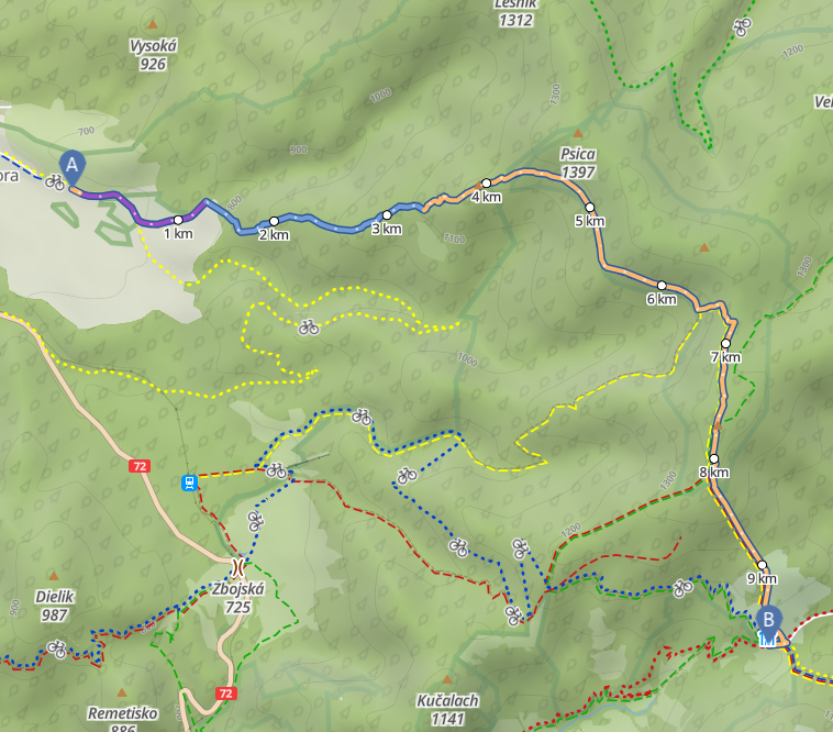
Outdoor route planner (for hiking and cycling) using proprietary algorithms for determining routes according to specific criteria.
If you are the creator or administrator of a tourism website or mobile application and you want to offer your users an easy-to-use solution that combines the features of a tourism search engine with a walking and cycling route planner, all built on a beautifully designed vector map base — you’ve come to the right place.
We invite you to test our unique system, which, when integrated into your website or mobile app, gives your users access to a fully refined mapping and routing module. You save hundreds or even thousands of development hours — simply plug in a ready-to-use solution that works immediately, with a subscription-based pricing model.
Our vector map base remains sharp and clear at any zoom level, offering rich tourist information such as trail networks with parallel routes and attractions, while accurately presenting topographic features through contour lines, hillshading, and detailed markings of rock formations, caves, mountain passes, peaks, vegetation, and more.
Our solution is developed as a cross-platform product and is designed for seamless integration with responsive websites as well as Android and iOS mobile applications.
The solution is designed to be as universal as possible during integration (regardless of the programming language in which the website or application is written) and easy to use by an administrator without technical skills and knowledge.
Integration with mobile applications allows you to use functions dedicated to mobile solutions, including downloading maps for offline use. Our map already covers the whole of Europe and any part can be downloaded and used in an offline mode.
Integration with your website or application ensures that all operations (search, route planning, etc.) take place in real time - super fast, without any delays in relation to the base system.
Currently, the solution is in the preparation stage for creating a prototype, the so-called MVP (Minimum Viable Product).
We're looking for companies that create and manage travel websites and applications to collaborate with. With your help, we'd like to conduct preliminary testing of this solution to identify any shortcomings and improve its functionality.